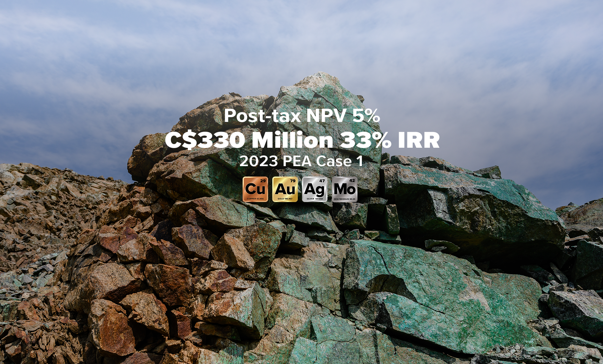
The Carmacks Copper Project is located approximately 47 km northwest of the village of Carmacks and 210 km northwest of Whitehorse, the capital of the Yukon Territory. The operating, high-grade Minto copper-gold mine is approximately ~30km north of the property.
The 176 square kilometre property is accessible by gravel roads accessed off the seasonally, government-maintained Freegold Road which branches of Highway 2 at Carmacks. Skagway, Alaska is 180 km by south of Whitehorse via highway and hosts a year-round deep-sea port with facilities for loading concentrate. The nearest electrical power supply is a Yukon Energy Corp. (YEC) transmission line 12 km to the northeast on the east side of the Yukon River.
 The Carmacks area has a northern interior climate with warm summers, cold winters and low to moderate precipitation (25-30 cm), most of which falls in summer. Mean annual temperatures are near -4oC. Modest snow cover remains from mid-October to mid-April at lower elevations and a month longer at higher elevations. The typical exploration season is from April to October.
Elevations range from a low of 600m in the eastern part of the project up to 1075m in the western portion, with most slopes being gentle to moderate.